I've had this on my list for a long while. I really like the Howgills, and the HHT is a practical sized round to complete without too much preparation (I'm really bad at preparation). With a gap between the Fellsman and the Speyside 100 of about 5 weeks there was some space available.

We drove up on the Friday night, getting to the Cross Keys about 10pm. The picnic area further down the road that I stayed at last time has been blocked off, so we ended up in a layby close to the Cross Keys itself. Late Friday night was the really vivid aurora display, so we were out until about 12.30 with cameras.
6.30 Saturday I got up, drove down to the Cross Keys and got us parked up. Made some tea while I got ready to head out. My bag was packed, I just needed to have some breakfast and get going. Claire hadn't made any firm plans, but was tentatively heading out the other side onto Baugh Fell (plus Wild Boar Fell, Swarth Fell & Bluecaster as it turned out).
 |
| A lot drier than last time! |
I set off around 7:40, heading up towards Narthwaite. I wasn't sure what to do about the river crossing here but as it turned out it was almost dry (the last two times I've been here it was ankle deep all the way across). Passed through the farm and out along the track towards Mountain View, turning right just after the old farmhouse to head straight up the fell.
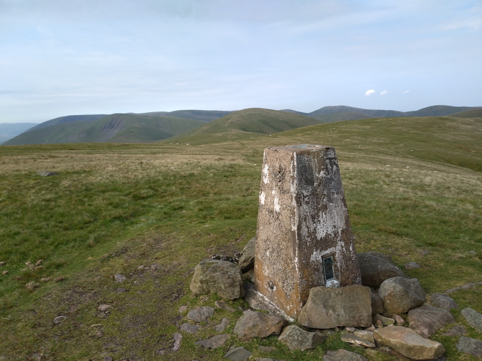
 |
| From Harter Fell towards the main range |
I was on top of Wandale pretty quickly. It was already starting to get warm and very clear. I paused to sort out shoe laces before heading down the other side to Adamthwaite.
Taking my cues from Tony's simple route diagram on the gofar website I went up the road from Adamthwaite instead of doubling back as I did last time, then got onto the fell at the bridleway. Straight up the gill to the top, and then down to the road crossing below Knott, filling my bottle at the stream.
 |
| Green Bell |
Knott is straightforward enough, cross the stream near the road then head straight up, then onto the trod towards Green Bell, veering off briefly to reach the summit of Knoutberry Haw. Green Bell was the first trig point of the day, and I still hadn't seen any other people.
A little out and back to Grere Fell, then back up onto the rather featureless summit of Stockless. From Stockless it's another short out and back to Hooksey before Randygill. I encountered a dog walker on the out and back, and warned her that I'd be coming back that way shortly in case she
 |
| Brunch on Yarlside |
was alarmed by my apparently weird behaviour. After Randygill the route then leads over a slightly boggy col and the smaller prominence of Kensgriff onto the steep climb up Yarlside.
I don't like the scree up this side of Yarlside, so I veered right off the obvious trod at the bottom and climbed up a steep but pleasant grassy strip between two minor reentrants onto the summit. Perching on the cairn I dug in my bag for the Jamaican pattie I'd put in my bag. I texted Claire, who was on her way up Wild Boar Fell, then dropped fairly sharply left down the side of Yarlside in the direction of Rams Gill. I aimed for the confluence of the two streams to fill my bottle from the smaller, steeper stream. I had a good drink while I was there, then climbed up onto the ridge to follow the clear track to Hazelgill Knott.
 |
| Rubbly scree on Langdale Knott |
From Hazelgill Knott the route continues on the track to West Fell. There was a group of people ahead of me as I faffed around trying to find the exact spot height location of West Fell, but I never got close to them. Then I dropped off on the tongue towards Langdale Knott. From Langdale Knott it's quite a steep drop, and most of the slope is covered in rubbly scree. It was this that put me off on my recce in October 22 (as well as the weather). Contouring north a bit, I found a stretch without much scree (although the grass was a bit deep and tussocky) and came down into the valley, noticing what looked like hut circles in the valley as I descended.
The river here was too wide to jump, and as I stood on a rock my foot slipped into the water. It was a very hot day though, so the cold wasn't a bother. I refilled my bottle from a side stream and headed up the next slope.
It's a steady climb up Middleton to the 2nd trig of the day, and I paused a minute to eat some malt loaf and cheese, then continued up Simonseat.
Docker Knott is a funny summit. When you approach on the trod from the Fell Head plateau there's a sudden very steep kick of about 10m. From this side that slope was clearly visible against the sky behind.
From Docker Knott the route calls for a visit to an 'unnamed spot height'. The OS map calls it "Hand Lake", and it's a not-very-distinguishable grassy summit. On then towards Rispa Pike and the little wind shelter, pausing again to fill my bottle. The minor stream I was aiming for wasn't running, so I filled up from the main stream which was flowing OK.
Rather melty cheese and malt loaf in the wind shelter, then something new. I'd never been to Archer Hill before. It's quite a nice little prominence over a small tarn. The next section was tussocky and boggy to Hare Shaw, and features something unusual in the Howgills - a fence. I hopped over the fence on each side of the enclosure and wandered around until my altimeter read something like the highest point, then headed on towards Blease Fell. From Blease Fell there's a clear trod that goes off slightly east to avoid the top of the gill, then zigzags a little to avoid bog but ultimately leads to the top of Uldale. More cheese and malt loaf on the top, then on towards Black Force.
Last time we were here we opted to drop all the way to the valley bottom and back up onto Ling Haw. That's a lot of height loss, although it's very direct, and the climb up the other side is pretty tough. Quicker to drop to the stream above Black Force and contour round on the path beyond. My planned bearing would have led to a section of stream that was in a deep gully, so I contoured round to the left to make the crossing. I drank lots of water at the stream crossing, then got onto the path.
 |
| Approaching Black Force |
Here I met some more people. First of all a young woman who seemed quite nervous of the
drop (it is quite an exposed path above a big drop). Then a couple more young women 50m or so behind (I assume they were a group) who were much more relaxed.

From Brown Moor it's a long hard climb up to Fell Head. From a distance it looked like there was a slightly zigzag trod, but it turned out to be a series of interconnected sheep trods. Some of these were actually useful, but it was still a tough climb. At the top the double summit foxed me once again, and I had to recheck the map to work out what was going on.
 |
| Looking back at the Tebay Fells from Brown Moor |
There were a couple of people ahead of me at this point (looked like young people), who I eventually passed between Bush Howe and White Fell Head. I could see people on the Calf ahead of me as I searched around for the spot height on White Fell. There was a little cairn by the trod, which I took to be the summit, and passed on towards the Calf. I expected the people there to have gone, but there were a couple of young lads sat on the base of the trig and a chap in a vivid orange jacket taking a selfie (he arrived back at the Cross Keys a little after me as it happened). One of the young guys asked which way I'd come - I gestured vaguely in a loop and said "sort of that way", then wished them a good day and headed off along the main track towards Bram Rigg. After Bram Rigg I veered off fairly early across rough ground to the top of Great Dummocks - another new one for me, then back to the cairn on Calders and down the horrible gravelly track. Near the bottom I met a mountain biker who asked where I was heading and where I'd been, and was a bit startled when he realised I'd done the whole range.
I got a bit confused before Arant Haw until I looked at the altimeter and realised the spur to my right was much too early and I needed to keep going to reach the substantial cairn. I'd last been up here in thick fog in 22 and struggled to find the summit. This time it was clearly visible, and covered in flags for the Junior Champs fell race the next day (or the adult friendly associated with it).
Down onto the Nab then the long slog back up. Contouring round towards Winder Fell I found myself approaching a very still young lamb. There were a few flies around, and I thought for a second the poor little thing had died - I've seen so many dead lambs and ewes this year. When I was almost upon it, it suddenly looked up and ran away bleating, so while I was sorry to startle it, I was glad it was OK.
 |
| Winder Fell |
Winder Fell was also covered in flags. More people - dog walkers this time. Claire had texted worried about where I was. We were trialling a cheap Sinotrack GPS tracker, and it was showing me some distance back. I reassured her that I was OK and nearing the last couple of summits. More malt loaf and cheese, and a really nice protein bar. Back down the track to Crook, a gnarly looking little hill with a huge cairn overlooking Sedbergh, which was also flagged for the fell race route.
 |
| Obvious path is obvious |
From here I contoured round to the weir further up the gill, only to find there was a clear track I could have followed if I'd descended a bit more. A lesson for me there.
Up Sickers Fell, then down onto Knott. The light was starting to fade just a little, and it was becoming a rather nice evening. Unfortunately the route from Knott onto the fell side path for the run in is a pain in the arse.
 |
| Final summit - Knott, looking back to Sickers |
Instead of the direct descent and climb I tried going further up the gill roughly where the streams meet (and the path shows a footbridge that was nowhere to be seen). Still not great, rocky and with the bracken starting to grow, but much nicer than last time. I think just a tiny bit further up the gill, then climb another 20m higher up the opposite slope before contouring round will avoid the gorse.
 |
| Green Bell on a fresh warm morning |
Speaking of gorse, once I was happy that I'd gone far enough on the clear trod round the corner, I dropped straight down a clear ride through the gorse onto the main path. After that it was a pleasant steady run in to the very end. I was now out of water and starting to get thirsty but not dehydrated, and still running OK. Claire met me near the footbridge at the bottom of Cautley beck and we ran in together.
Final time was around 12:20 - I'd thought 12 hours was about right, and I'd stopped quite a bit to enjoy the view, eat, and around ten minutes chatting with the biker on Calders. It was a fantastic day out and one I'd cheerfully repeat. One to share with Claire perhaps when her various niggles have eased - the constant climbing is great fun and excellent training.
A cup of tea in the van, then home by about 10pm.
Kit List
- UD Blazek pack
- Raidlight T shirt
- Decathlon shorts (butchered to remove the horrible built in liner shorts)
- Columbia outdry ultralite waterproof
- Decathlon waterproof trousers
- Printed map with route shown
- Harvey Howgill Fells map (out of print, got a couple from ebay)
- Suunto A30 compass
- Salomon water filter & 2 Hydrapak bottles
- Inov8 X talon ultra 260 shoes
- Black Diamond Talus gaiters
- Montane windproof gilet
- Sinotrack GPS/GSM tracker
- Drymax ultra light crew length socks
Food
- Large malt loaf
- 5 slices of edam cheese
- Nice salted caramel nut bar
- a LOT of water, mostly stream water through the filter.
No comments:
Post a Comment