Monday 23 November 2020

8 Trig Circular

Trig 1 - Deerstones
 This route started as the LDWA Six trigs challenge. I've tried that route a couple of times, and there are sections of it that are really grim. When I started looking at ways to avoid the worst sections I found that I could drop onto the Pennine Bridleway and avoid Birkin Clough (probably the nastiest section), and take in an additional trig (Delf Hill). I'd already decided to add in Standing Stone Hill as it's pretty easy to include (or so I thought...).

I had a crack at my modified route anticlockwise last weekend. The weather was awful, it was really windy, and I set off far too late. In the end I completed 7 out of the 8 trigs before bailing out at Bridestones.

This week the forecast was much nicer, so I decided to get the thing out of the way. I opted for clockwise, mainly to get the unknown navigation done immediately.

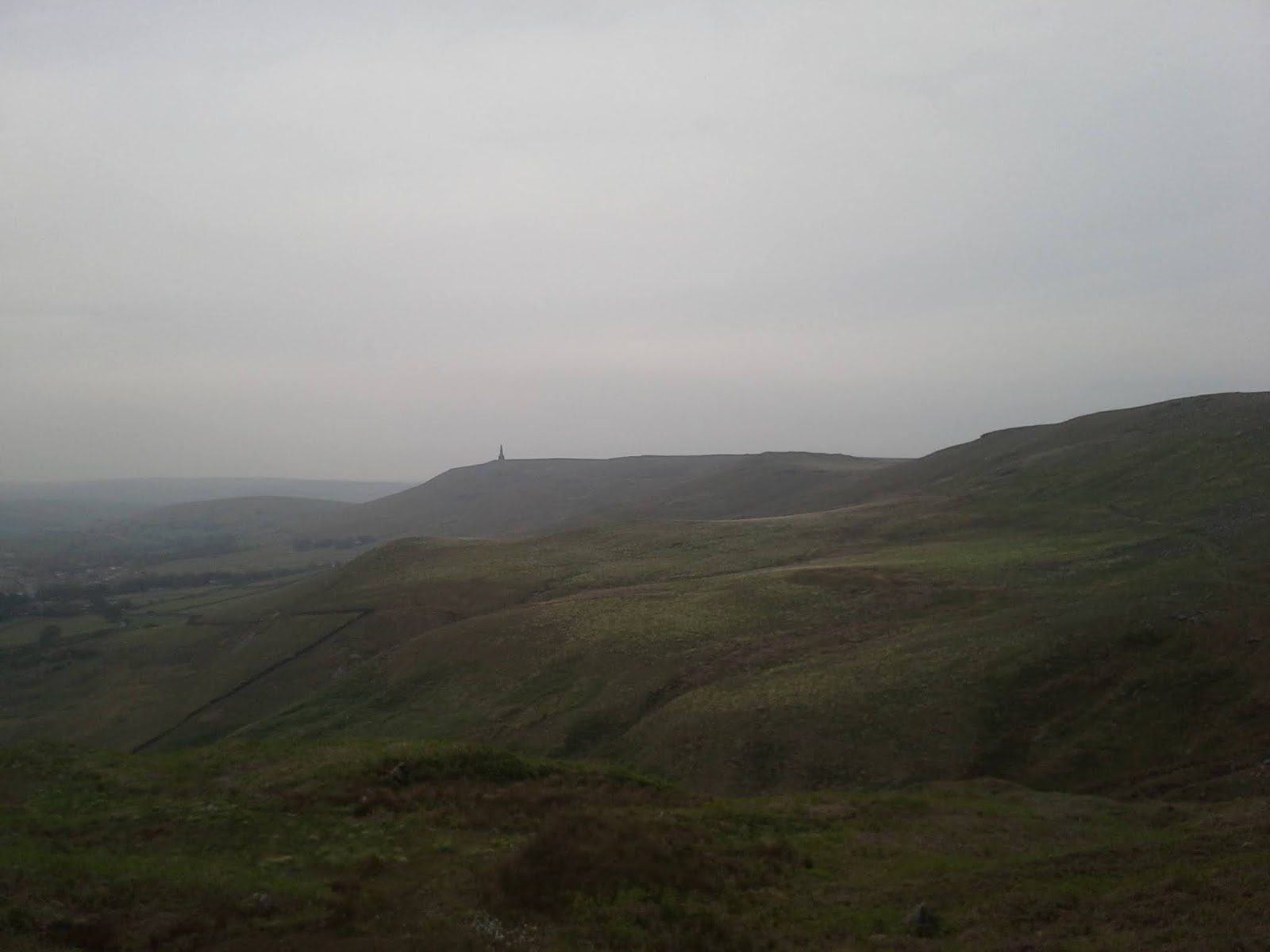
Starting from Deerstones trig at about 9.45 (having left home at 9.15 and climbed slowly up the hill), I immediately had to stop and put on a waterproof, as a band of rain came over the top of Crimsworth Dean.

A steady run down to Hardcastle Crags, which was rapidly filling up with visitors, and then I climbed up to Heptonstall Moor from the back of Gibson Mill and on to Standing Stone Hill.

Trig 2 - Standing Stone Hill


Trig 3 - Bridestones
According to the map, there's a fairly direct route from Standing Stone Hill across the beck at the top of Colden Clough and up to Dukes Cut. It turns out to be a crappy route. An elderly lady from the farm there was bemused that I was even trying, it doesn't seem to be used much, and the path is unmarked. I'm pretty sure I took the right line on the east side of the beck, and ended up ignoring a 'no pedestrians' sign and hopping over a wall. I recommend against this route.

On the other side it's still unclear where the path is, but I was able to climb straight up the next two fields and join the track leading up to Dukes Cut. From there it's a steady run on to Bridestones.

Because it was a nice day, it was busy up here. Lots of mountain bikers. One well spoken middle aged couple gave me a cheery 'hello' as they close passed without slowing, splashing me with mud up to my face. Thanks for that.


The sedge tussocks and boggy delights of Hoofstones,
I paused at Bridestones to take a photo and chatted to a lady with a sight hound about cats. Then on to Hoofstones. Weirdly this section was probably the busiest all day. Along the walled track below Bridestones I encountered 2 largish groups (although probably only two households per group thinking about the composition), then on Hoofstones, one of the boggiest hills in the area, I saw two separate couples out walking.


Trig 4 - Hoofstones Heights

From Hoofstones trig my original plan was to follow the boundary down to Sheddon Clough to skip the section to the Gorple track, but I tried that last weekend and it was pretty rough. I don't think I've ever seen tussocks as big as the sheep before. So this time I hopped over the stile and followed the path towards Gorple. It was less grim than last time I was up here, although there were some very wet sections.

Gorple res, near the end of the first boggiest


Down the Gorple track to join the Pennine Bridleway west of the plateau meant losing a lot of height, but Birkin Clough is worth avoiding, and this diversion makes it possible to pick up Delf Hill. The best way up Delf from this side is to cross the wall on the south side of the hill, climb up with the motorbike scrambles to your left, pick up the trig then carry on to the far right corner of the field. There's a little gate there that gets you through the wall which you can handrail back to the bridleway (although it's boggy and tussocky).

Trig 5 - Delf Hill

Belties on Delf Hill


Another massive loss of height, then back up on the Pennine Bridleway, soon joining the Pendle Way before turning off for the slog up Lad Law. The path up Lad Law goes off to the right at the information board next to the path, and I stopped here to put away my map, dig out the GPS and refill my front pockets with food.

It was starting to get a little late in the day as I reached the top of Lad Law and I was keen to get across the plateau in daylight. As it turned out I had plenty of time, leaving the trig at 1510, I was at Haworth Moor trig half an hour later, having wallowed and zig zagged all over the place. It's really difficult to find the parish boundary path from the Lad Law side, but I did eventually find it after falling up to my thighs and elbows in a cold bog pool. I always find a GPS trace helpful on this section, although the limit of accuracy of the GPS combined with the featureless terrain still make it tough going. For future reference I think I need to err off to the right/downhill then climb to find the boundary path.


Trig 6 - Lad Law

The rain came in as I dropped behind Top Withins farmhouse, and I was already freezing cold with sore feet. I put a buff around my neck to keep the heat in, which was surprisingly effective, and as I set off across the Waste the rain eased off and eventually stopped.

Trig 7 - Haworth Moor

I finally lost the light at the top of Stairs Lane, which I was OK with as it left a few miles of very familiar ground to cover in the dark. My experimental food (peanut butter/instant mash 50/50 mix) had been very effective and I still had plenty of energy. I was warming up again after my accidental bath and enjoying the last few miles. I crossed Keighley Road and climbed up onto the top, and High Brown Knoll was the first trig I reached in darkness (and the 2nd to last trig of the day).

Trig 8 - High Brown Knoll

I took the most direct route I knew across Midgely Moor and got back to Deerstones trig 2 minutes inside 8 hours. Not exactly fast for 50km, but not far from what I'd expected given the terrain, loafing around admiring the view and taking photos.


Trig 1 again, Deerstones. My camera must have got wet.


Wednesday 18 November 2020

The neuroscience of natural skills

As I've said elsewhere in these posts, I'm various kinds of outdoors-ist. I'm also a bit of an amateur neuroscientist (I studied cognitive psychology and the neurobiological end of psychology in the days before the term 'neuroscience' was really used). Reading Tristan Gooley's "The Natural Navigator" prompted some thoughts about how learning and perception works, and how that relates to the things that humans do in their interaction with the natural world. I'm particularly thinking about moving around in natural environments, foraging for food, hunting & so on - the things that made up our evolutionary history.

To set the scene, we need to look at how brains work. This is true of all animals - mammals, fish, insects, birds. It's also a massive simplification, just enough to understand the underlying concepts.


Brain cells

The nervous system is made up of cells. Neurons, of various sorts. They are basically little signalling pods. When they get a signal, they pass it on to other neurons, varying the strength of the signal.

Each of these pods signals something very simple - just how strongly it's active. It takes billions of them to make up a brain, and they work together to represent anything - a concept, a sound, something in your vision. You can think of them as being a bit like the pixels in a computer screen, it takes a large group of them to represent anything, but one neuron can be a part of lots of groups.

When we learn something, we don't learn it all in one go. Those connections between the neurons adjust their strengths at a coarse level to start with, then as things are repeated the adjustments are progressively finer. 

You can see this in child development - a very young child makes large, clumsy movements when walking, handling objects etc. Gradually their motor control becomes finer and more subtle.

That's often thought to be a child development thing, but actually you can see it in adults when you learn any manual skill, like driving a car. To start with, your movements are jerky - the clutch is all the way on, then you declutch in a single large movement and the car lurches forward and stalls. Gradually those movements become finer, until you can balance the clutch and throttle to start on a steep hill easily. Eventually those motor skills are so finely learned that you don't even think about them, and you can drive to a place and suddenly realise that you've not really thought about the process of driving for most of the journey - you may even find it difficult to remember the journey at all.

It's important to note that although we think of developing fine control of physical movements (dance, learning to use tools, playing a musical instrument) as a muscular development, it's almost entirely a neurological thing. We're teaching our brain how to send the precise signals, and the nerves embedded in our muscles how to interpret them.

This is a fundamental of brain organisation - not just humans, not even just mammals, but how nerve cells throughout the animal kingdom work.


Natural skills

This 'gradually finer detail' applies to sensory discrimination too - the more you attend to sounds, sights and sensations in the natural world, the more finely you'll be able to discriminate between different things. That's where it starts to have a really noticeable impact on outdoor skills, which are mostly about understanding the environment you're in. I'll return to the theme of immersion in your environment in a later post.

A friend and I have been mushroom foraging together for some years. A few times a year we'll head out with field guides, baskets and magnifiers to see what we can find. There are certain species that we aim for - ones that are easy to identify with a high degree of confidence: amethyst deceivers, boletes of all sorts and the 'pied de mouton'/hedgehog fungus particularly. What we've repeatedly found is that we can identify likely candidates for our target species from quite a distance, through tiny holes in leaf litter, purely down to the particular shades of colour they display. We're not always right, positive identification is still necessary of course, but being able to spot likely mushrooms easily is an obvious advantage for an animal foraging for food. This has come about through looking at hundreds, thousands of mushrooms and unconsciously learning to recognise very subtle patterns in shape and shade. In our 'natural' state as animals, we would learn to discriminate many different foods from childhood in this automatic way. The colour discrimination is so subtle that I can fairly confidently spot deceivers (the brown variant of the amethyst) by their similarity to their purple cousins. (I don't collect deceivers, they have that name for a reason.)

Natural navigation

Back to Gooley and natural navigation. He makes much mention of Pacific Islanders' navigation ability using patterns of currents, appearance of the water, stars, and other means. It seems likely that someone who has spent hundreds of hours practicing navigation on the open sea by a combination of different sources will just 'know' where they are in relation to their surrounds, and probably have to think carefully to express what contributes to that knowledge.

This is what the brain does. It responds to repeated training of the same information to a point where it becomes automatic. This is what natural skills should be, not a set of handy tips and lists, but an integrated unconscious awareness of ones surroundings.


Monday 2 November 2020

Spire Ultra 2020

I haven't done one of these for a while. The last race I ran was the Pendle Way in a Day, which I haven't got around to writing up. I will do at some point.

Rather like the Pendle, the weather at the Spire was fairly grim. I stayed at the race start the night before, and my camper was heavily buffeted by wind and rain all night, waking me up several times.

I got up around 7, had some coffee and wandered up to the main parking field to register. I said hi to Jamie & Claire, picked up my race number and goodies, and headed back to the van for another coffee. When I opened the van slide door to get rid of the coffee grounds there was a 'flutter' noise, and this was when my race number blew out of the cab where I'd left it. That was the first cock up of the day. I spent about 15 minutes looking for it, then had to head for the start and my starting 'pod'.

Walking up to the start I bumped into Ian Challan, and spent a few minutes chatting. Unfortunately it was further to the start point than I realised, and I had to get a move on to make my start time. Reaching the start, Jamie told me that he had my race number in his car (along with the stopwatch he'd forgotten) so I ran back down with him to fetch it. My race number had been found by another member of pod 6 and handed in (thank you).

We got going at 8.27, and started by dropping downhill for quite a while. I settled in at the top end of my target speed range for the day (9.5kph) and trundled along. Fairly soon the quicker runners in the pods behind us started catching up.

Somewhere around this time (just before crossing a dam) I slipped for the first time and landed on my knee. No major harm done, although after the race I discovered a hefty graze. I'm gathering quite a collection of scar tissue on my right knee.

A few minutes later I slipped again, this time on a greasy stile, and landed on my left shin on the top bar of the fence. It didn't hurt, but I had several seconds of scary wobbling as I was balanced on my shin trying to grab something to stabilise myself. I eventually managed to gain some control and resolved to be careful the rest of the day.

After that it was fairly steady sailing. Characteristically I was over equipped - because I mostly run solo on high exposed ground I'm used to carrying a lot of kit, and often over prepare for events like the Spire in more forgiving settings. At some point I needed to shed a layer, and accidentally paused my Suunto for about twenty minutes, which vaguely annoyed me (although in the evening I was able to crop a perfectly good record of the race from my handheld GPS).


CPs came and went, every 10km or so I made an effort to eat a little peanut butter, and the wind buffeted.

Coming up to Sutton Scarsdale I discovered that I'd accidentally left the backlight on my nav gps, and the battery was flat. Luckily I always carry a 2nd set of batteries, so a couple of minutes by the track fixed that. I cooled off quite a bit while I was stopped though, and struggled to get back up to pace.

From Heath to North Wingfield was fairly flat, and although I was feeling it a bit by that point I managed to keep an ok pace going, just occasionally slowing to a walk for a short spell. North Wingfield back to Ashover was harder going - my energy was running out, I'd paced a bit too high and the mud and wind had sapped my energy. I kept going, but much slower. My average speed dropped dramatically here, from over 9kph to 8.7 or so. Another runner overtook me in the last km, and gave me a much needed boost.

I was glad to see the finish at High Ashes Farm, and lots of cheering from the finish line marshals.


It was cold up at the finish, and I quickly changed into warm clothes and sat in the back of the camper guzzling coffee and shivering for a quarter of an hour or so.

Jamie and Claire and the marshals did a fantastic job of keeping the race going in a difficult year for events. Everything was well managed and reassuring, people took sensible precautions and the marshals still did a fantastic job of supporting the runners. If anything I think the route this year was better than last - the finish at Ashover makes the last few kilometres more challenging.


Back into lockdown now. Hopefully next year will be better for racing.


Friday 4 September 2020

Getting started creating routes

I've noticed one of the most frequently asked questions on Facebook trail running pages is "does anyone have any routes/how do I find routes to run". Invariably a few of us will answer "get the OS map", but it's not necessarily that simple even if you know how to read a map.

The other day while I was out running I was thinking about how I devise my routes, based on a good many years of running solo, leading walks for the Ramblers etc.

So my 'getting started' tips for getting in the habit of working out your own routes are as follows:

Buy walking guidebooks

Routes you can walk are generally routes you can run, although walking guides tend towards fairly short routes. They're a starting point though.

Green diamonds are a runners best friend

The green dotted lines marked with diamond shapes on an OS 1:25k are the major longer distance routes: the Pennine Way, Offas Dike path, South West Coast path etc. These are well marked, clear paths you can use as a starting point for routes. Use a section of your local long distance path as the outbound or inbound leg of a route, or as a starting point for a route.

Enter races

You don't have to religiously stick to the race route. For the last 18 months I've been riffing on the Hebden LDWA event route, using it as a baseline and varying odd bits here and there, adding some mileage here, taking a new path there.

Out on the Calderdale Way, home on the towpath

Yesterday I ran out along the Calderdale Way to Norland, and realised that a good return route to my home in Mytholmroyd would be the first 5 miles of last year's Calderdale Hike via Sowerby village.

Every bit of exploration helps you to understand the area and get a mental picture of how it fits together.

Link up particular locations

Work out how to get to a place (trig points/hill tops/villages), then the next, then the next. Those are your checkpoints (probably no cake though, unless you carry it with you or link together tea shops). Some classic challenge routes are just a group of hill tops/trig points linked together.

Explore a bit at a time

Unless you're running in wide open national park, you're going to be stringing together separate paths around farmland, settlements etc. If you work out a route with lots of minor paths you're going to be spending a lot of time peering at your map. That's great if you're training for better map reading skills, but if you're training for fitness or just want to run free, try to run a familiar or well waymarked route but add little variations, short sections with new paths. As the area becomes familiar you'll start to see opportunities to build routes by stringing together places you've explored, or add distance and ascent on the fly when you're running well.

Get your boots on

OK, I actually walk in fell/trail shoes, but you don't put so much pressure on yourself to move fast when walking. That gives you chance to notice the topology of the landscape and the local paths, and allows you more freedom to experiment and stand for ages reading the map without caring that your average pace is dropping.

There are lots of things that contribute to a 'good' route, and it can vary from person to person. If you can read a map but aren't sure how to get started constructing your own routes, these steps might help.


Monday 15 June 2020

Living with the geology

after how ever many weeks of lockdown it is, I've left the Calder valley on wheels only once. Last weekend I had to drive to Bradford to pick up a flute.

Following the dual carriageway along the middle of the Aire valley from Keighley towards Bingley and Saltaire I was struck by the wide, shallow valley and the gentle slope of the hills on either side. This contrasts starkly with Calderdale. The Calder valley is a steep sided, narrow cut in relatively flat uplands. Very steep sided.

Stoodley Pike, Calder Valley
It's taken a while to notice the side effects of this. In Silsden I was halfway up the hill on the north east side of the valley, and very much subject to the blasts of the prevailing wind and rain. Here in Calderdale the experience is very different. Temperature inversions are commonplace - it's difficult to tell from the valley bottom whether the hill tops will be warmer or colder. The valley bottoms rarely get strong winds, they tend to blow straight over above us. On the other hand, it rains a lot and floods very easily.

Modern society is largely insulated from the effects of climate, and the interaction between climate and geology. Those of us who run on the tops see more of it, but you need to change location and be conscious of your surroundings to learn more about how it fits together.


Monday 27 January 2020

Fellsman kit

The Fellsman notoriously has the most thorough (and rigorously checked) mandatory kit list of all UK ultramarathons. Videos exist demonstrating that you can get all the mandatory kit for e.g. the UTMB (a very long, very hard, very prestigious race in the French alps) in a 3 litre race vest. You haven't a prayer of doing that for the Fellsman.

The reason is simple: the organisers want you to finish, which means you're out there in April against whatever crazy stuff the not-too-distant Atlantic decides to throw at you until the end. Bright sunshine, howling gales, torrential rain, snow: all have been known, sometimes within the same 12 hour period.

After a couple of unfortunate incidents with ill-equipped runners getting hypothermic a few years back, the Fellsman requires a lot of warm clothes, and 2 emergency fall backs (a survival bag and a foil poncho).

I was planning on using a 15l Omm Ultra pack for this, but having done a few 50 milers with it, it rubs my back and hurts my shoulder. Plan B is a 12l race vest.

It's a bit of a squeeze, but I think I can get everything on the kit list in, plus the extras I want to carry.


 clockwise from left:

Spork
Drysac for spare clothes
compass, & foil poncho below it
SOL survival bag, with waterproof coat, then trousers below
First aid kit (I'll carry a smaller one than this) with gloves, backup torch and spare batteries below
Inov8 insulated jacket & Montane Prism hat
Additional layer (this is just a warm fleece base layer, chosen because it's fairly bulky, with Petzl Nao2 headtorch above
Buff, with Harvey Fellsman map above
MSR titanium mug.

This assumes I'll be wearing 2 upper body layers and carrying 3, which is likely. On the day I'll make a call on what to actually wear, but it'll probably be a Raidlight top (which means extra pocket space).

I still need to include emergency food, and eating food. That means 300g of cheese, 2 baby food containers of peanut butter, and various bits of cheese, nuts etc. My nav GPS will go in the pocket of my race vest, as will additional buffs, my Buffalo mittens and one or two other bits.


I'm pretty sure this is all going to fit OK, but I'll do a trial run on an actual run sometime in Feb.

Just a reminder that I'm doing this in aid of Yorkshire Cat Rescue. If you want to make a donation, you can do so here:

https://www.justgiving.com/fundraising/charles-colbourn4