We decided a while ago to make the SIMM the centrepiece of this year's summer holiday in the same way that we did last year's Mourne MM. We decided to stay in France for the majority of our time (for the language practice among other things), so we looked around the Grand Est border. We ended up with Besançon (because it's near the border and moderately hilly) and for the first week Vesoul, for no better reason than because we knew of it from the Jacques Brel song (also covered by Pomplamoose in a slightly less manic version here ).

We drove the camper down to Vesoul, staying over in a picnic stop near Arras on the way down to break up the journey. In the picnic spot, because we'd been driving all day we ended up walking in circles for about an hour to get Claire's daily steps up to 10k. The rabbits and truck drivers must have been most confused by these two idiot rosbifs walking round and round a tarmac carpark.
We spent a pleasant week in Vesoul exploring the modest local hills and extensive local forests, and seeing lots of wildlife. Near the end of the week we got the email from the SIMM organisers to say that there was a problem...
The expectation was that competitors would park in the Stillerenbuhl cable car carpark for the weekend. Unfortunately the Stillerenbuhl car park doesn't permit overnight parking, and this had only come to light at the last minute. The alternative offering was the underground carpark in the centre of Adelboden.
This was a bit concerning, as underground carparks tend to be too low to get the camper into. Mandy & Phil said they'd probably drop out since their camper definitely wouldn't fit. After an email to the organisers didn't elicit any response I went digging for information and discovered that in theory the van would go under the 2.2m barrier. OK, we'll take a punt on it.
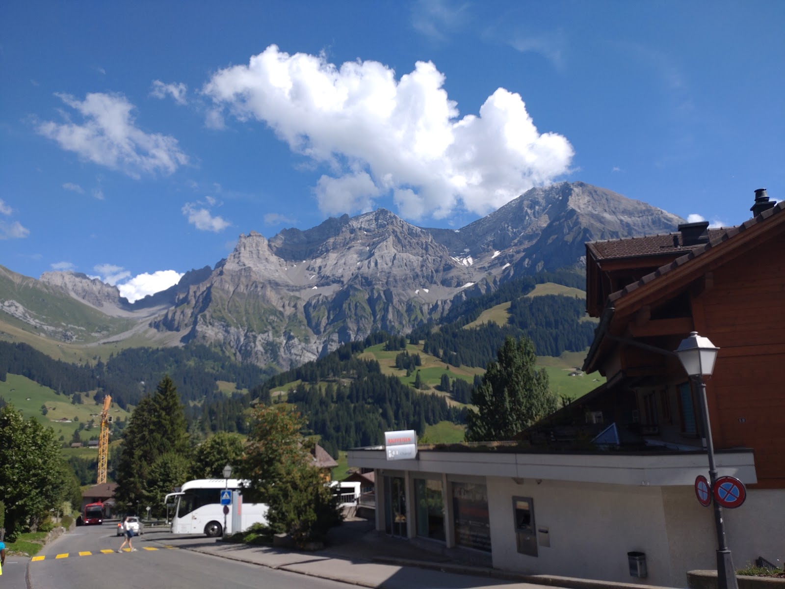
We drove down from Vesoul to Adelboden, which took a good few hours. There was some confusion at the border when the customs officer asked Claire if she spoke English or French, and she responded that either was fine in perfect German...
The SIMM organisers had suggested getting an official map of the area which took up most of the free time we had before registration (along with getting money out of an ATM in Spiez, since the IBAN payment method had turned into a bit of a mare). In the end the official map wasn't that helpful - the maps provided by the organisers had as much detail as we needed. We went to registration and more linguistic confusion ensued. The SIMM official language is Swiss German, but they do a great job of speaking alternative languages and since we both speak French and some German (not much in my case) we tended to respond in whatever language we were addressed in. Or sometimes the last one we'd spoken. Or the one someone standing next to us was using.

Once we'd finished registration (then gone back to pay, which everyone had forgotten about including us!) we walked down through Adelboden to our accommodation at a youth hostel type ski lodge on the outskirts. This was eye wateringly expensive at 120E for the night, and I took particular issue with it because it was distinctly shabby and unsupervised. A group of 3 young people were sharing a 2 person room next to us and made a lot of noise well into the early hours. The two Italian guys on the other side were quiet, although one of them snored like a walrus the following night when they happened to be pitched next to us at mid camp.
Early saturday morning we got up, had some breakfast and walked up, up and more up to the Adelboden Post to catch the bus to the start. The bus was full of MM competitors, and quiet subdued conversations were happening in French, German and Italian. Plus one very loud conversation in English. A couple and a young woman standing just behind us were chatting VERY VERY LOUDLY in an embarrassingly British kind of way. Claire and I talked quietly between ourselves and tried to pretend we were French, something we found ourselves doing quite a bit this holiday.
At the cable car there was a huge gravel car park, which would have been a good place to park as it happens. A couple of camper vans were visibly informal camping there, which might be useful to know. I'd anticipated that Switzerland might be a bit restrictive on that front, I'll have to look into it.
We loitered around the cable car station and allowed the crowd to get ahead of us while we filled water bottles, then took a car up to the top. There was a path coming down the steep mountainside that looked horrifyingly exposed, which didn't fill me with confidence. Once we reached the top we found a quiet spot to wait, then we waited.
We'd been booked on the 8am bus to the start, and the mass start was at 10:30. This meant a long period of sitting around. The mass starts are a slight drawback of the SIMM - easier for the organisers but it does mean the competitors in the linear courses end up in a long drawn out line more or less following each other (unless like us you're slow or insist on going your own way for the fun of it, even if it's slower than the orthodox line).
At the start we filed into the taped off area and collected our maps. Once the start signal was given we opened the maps. It took me a while to get my head around the orientation - Claire was quicker and took us in roughly the right direction. We climbed too much over a nearby hillock while the rest of the Parcours 3 people went round the bottom, then dropped to the approximate location of the control.
We stood next to the control for a while trying to puzzle out if it was right, and eventually just went and looked at the number on it. Sure enough, it was right (the little rock next to it didn't look much like a crag as the control list had it) but now we were oriented and got going on to the next one. We had a bit of confusion over map scale on this leg which led us false about the appropriate distance, but sorted it out. Next up was a control on the far side of the bowl. It was clear enough where it was, but in trying to scrupulously avoid OOB areas we ended up on the wrong path and had to correct.
Climbing the slope to the control we caught up some of the teams ahead of us. A couple of boulders on the path made a good attack point and a very neat line to the control, then we were contouring on to the next one.
This was in the junction of two reentrants and as it turned out was partially taped. We missed the tapes but came up onto the control and got wet feet on the river crossing. The leg to the next control was fully taped and we followed it to the manned control, where we were greeted by a couple of the very friendly SIMM volunteers. That was an ongoing theme throughout the weekend - the volunteers on the SIMM are really, really friendly and enthusiastic. Such a happy bunch of people, it really helps the atmosphere of the event.
We crossed another stream on the climb towards the Ammertepass. I refilled my (filter) bottle at this point as I'd gone through half a litre of water. I think I didn't drink enough on day one, although I had about 2 litres.
We slogged our way up to the top of the Ammertepass. It started to get colder as we got up around 2400m and the breeze was cooler. We were still comfortable in shorts and t-shirts though.

At the top we dibbed at the control and moved along the path. There was a warning of a narrow exposed path (not my favourite thing!) and we checked the map. I thought we needed to backtrack slightly and stay on the other side of the ridge for another 100m, but the marshal on the control corrected us and as we progressed I could see there was no path on the line I'd expected to follow. Looking at the map later without contact lenses in, it was clear that it went along the ridge top, not sure why I read it differently at the time.
The path across the pass was quite exposed. It dropped off quite steeply to the right and was fine loose scree. With a big pack on I didn't like it at all, and neither did Claire. We baby stepped across until the exposure improved, although it was slippy and gnarly for quite a long way down.
Eventually we cleared the scree and started dropping down a zigzag path down a very steep nose. On a section across a large boulder assisted by a rope, a woman ahead of us fell (bruises only) which alarmed me - the prospect of doing first aid in this situation was a bit much. Luckily the photographer slightly below shouted "artzt!" and ran to her assistance, getting me off the hook.
We made our careful way down across this rock, and others assisted by chains, and reached the next control which was in a ruin by the path. No, not that ruin, this ruin. Sneaky!
The next leg was long-ish and offered some route planning opportunity. We sat in a hidden spot past the ruin and worked out what we thought was a good line (others followed it too, so I guess it was probably OK) then set off. Passing a refuge hut as we descended I filled my bottle (non-filtered).
We followed a good path for quite a way then climbed up a steep slope (as usual ducking under multiple electric cow tapes) to reach a farm, then picked up another good path that took us most of the way to the control, just following a bearing for a section. Claire fell on this section trying to get through a really awkward stiff gate - I wrenched the thing open and held it for another pair who overtook us just here after having travelled with us for a while.
Around this point it started to thunder. As we followed the contouring path there was a loud CRACK, I turned around just in time to see the lightning hitting the top of Ammertespitz a couple of km away. It was a pretty spectacular strike.
We reached the next control (manned, in a bog), then planned the next leg. I made a mistake here and chose to keep height and drop down, when a contour round would have been much more efficient and given us a better attack point. We dropped down a steep slope onto the control then climbed straight back up it again. We followed a fence line all the way to a path that took us through a narrow channel through OOB almost to the final control.
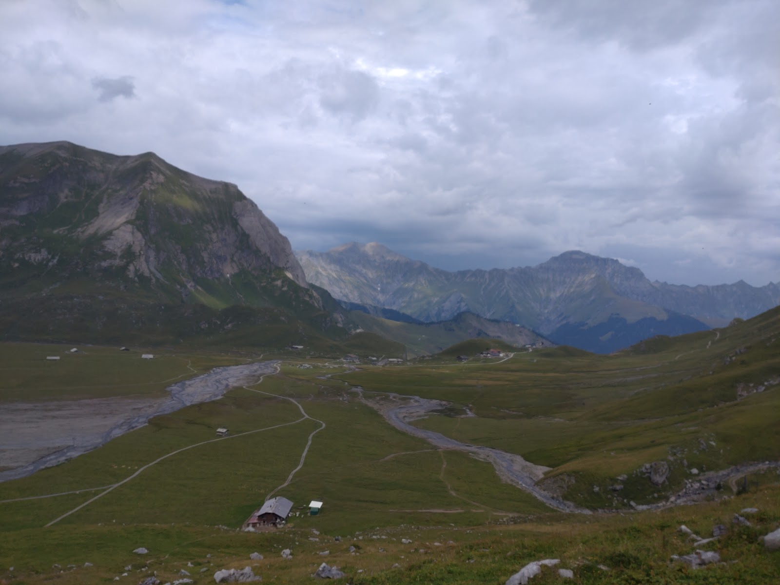
Mid Camp

we arrived at mid camp and were immediately kit checked. Just a couple of items then we set out to find a good camping spot. The mid camp was, of course, stunning but of course (being the alps) richly supplied with cow pats. We found a spot that was fairly cow pat light and reasonably flat and pitched our tent. I went and fetched water then we changed into clean, non-sweaty clothes.

A cup of tea, then Tent Meals overlooking the mountains, followed by some cheese. Every once in a while another team would arrive, to be greeted by what we later learned to be a chorus of Alpen horns but sounded at the time like a rather morose harmonium. We joined the crowd of people watching the sun set over the mountains then went back to our tent for a couple of glasses of wine and some more cheese.
Day 2
Mass start was at 8am, although there was an announcement by loudhailer at 6am that we didn't understand. We sat drinking tea and took down our tent in plenty of time and were ready and packed apart from toilet visits. The queue for the toilets was huge, and we were finally ready about 7:59:45.

Once again we filed into the taped area, dropping our litter into the bag provided and collecting our maps. The start signal went, and we opened the maps and worked out the direction of the first control. I misread the contours (again. Contact lenses, again. I need to make more use of the magnifier). We didn't gain excessive height though, and only dropped about ten metres onto the control. The next control was easy, a boulder near the path, then we were following the track down the valley to a control partway up a crag. This was another obvious one once we got close and we were able to follow a bearing right up to the control.
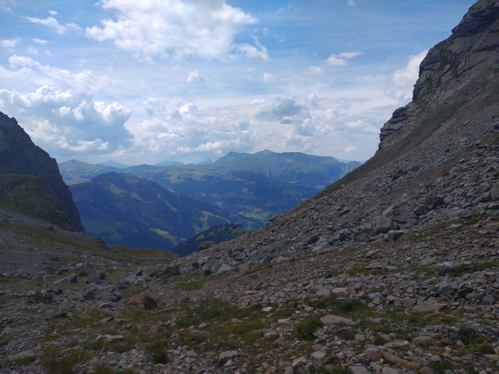
Back down to the track then along to a path junction that was a handy attack point for the next control. Then a decision point. There were two possible actions here - carry on down the valley to a path a few hundred metres away, then work a way through the OOB or take a long route by road. Or go straight up the steep incline and down the other side.
We were a bit sick of following other people. That's always an issue in a linear course, but more so when there's a mass start. SIMM do the rather neat thing of setting everyone off on day 2 with the same spacing as they had at the finish of day 1, unless you're over an hour behind the fastest team. For those of us just out for a fun bit of orienteering it's a mass start. This was only the second linear course we'd done in a MM, and we chose it out of caution. If we come back next year we'll definitely do score.
We looked at the steep slope of Hüendersädel above us. It looked steep but do-able, something we wouldn't hesitate to climb in the Lakes. We considered both options for a while - faffing, as Mandy would probably say.
We chose the steep climb and worked our way up it. The undergrowth was much deeper than we'd anticipated and it was tough going. On smooth ground Claire can match me or leave me behind - she has much greater strength and cadence. On the rough stuff I have the advantage of much longer legs, I can step over things she has to climb and burn much less energy for the same distance. Towards the top this slope got really rough and quite steep, and at some point Claire lost her map squeezing under an electric fence. By the time we reached the top she was hypoglycaemic and totally fed up.
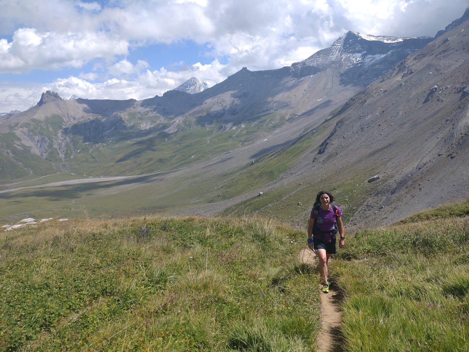
We couldn't get down the other side as the tree cover was too dense (another map symbology fail on my part) so we rambled steadily south westwards along the top towards a path down. Once we dropped into the valley below and paused for something to eat Claire started to feel better, especially after she saw a couple of marmots running by.
We worked out a route to avoid the scattered OOB areas in the vicinity of Gilsmeder and ended up with a pretty good line from where we were towards the next control under the cable car lines at the other side of the valley. I looked at the type of control and got it completely wrong. 'Circle' does not denote a hill, that's 'oval'. Circle denotes a 'special control'. In this instance it turned out to be a cable car pylon, as I discovered by looking down from the top of the hill I was scouring fruitlessly in search of the control.
We set off down to the control. I took my bag off and slid under the wire, then Claire did the same. Losing her grip on her bag on the steep slope it plummeted down ten metres, bouncing off the hillside and landing in a pond. I was partway down and rushed over to grab it before too much water soaked through. Thankfully there didn't seem to be any damage, although I was sure I'd seen something spinning in the air before it landed.
That turned out to be Claire's phone. "Find my phone" from her Garmin led us to it buried in a bush nearby, completely unharmed. We dibbed the control and clambered back up to the fence line.

The next control was on a stream at the top of a gully. We set off on a bearing for the top of the gully and plodded up the steep slope. Near the top we caught 2 young women who'd been ahead of us at the last control. We all left the path together at the obvious attack point of a small tarn and worked our way round the gully until we found the control, a bit further north than we'd anticipated.
After that there was another contour round to a control on a forest corner. One team was climbing much higher up the hill, not sure why, we contoured pretty much straight to the control in a stream bed on the corner of a forest. We'd pulled slightly ahead of the team who'd been with us at the last control and met them again as we started plodding uphill to the top of Sillerenbüel. I stupidly didn't fill my water bottle at the stream, and as we climbed the hill we started to get really thirsty.
We reached the top, passing another team of two young women (who we passed and repassed until they ran into the last couple of controls and we continued to walk), then spent about ten minutes trying to find public loos where we could get water. Eventually we learned that you could just walk into the restaurant and use theirs - not sure if there was a cultural convention there we missed, or if it was just Sillerenbüel.
Down the slope past a wooden carving of Heidi, then a control on a tree in the middle of the forest. It was actually pretty easy to find if you came in on a decent bearing, and we dibbed and headed out. The next control was more or less straightforward, a hill (yes, an actual hill this time) across the valley. We found a path that made a good approach then climbed up to the right height. I've not mentioned it up to now but we used the altimeter more on this event than ever before, which shouldn't be any surprise.
The next leg took us down a dried up river bed/moraine slope that was really hard underfoot. It was interspersed with belts of shrubby tree growth and really hard to hold a bearing on. The team we'd passed on the way up Sillerenbüel were close behind but fell further back as we battled through. We finally came out almost on top of the control which made me very happy. After that we tried to drop straight down the field to the river, which was a 3 or 4m drop onto rocks so not really feasible. Eventually we worked out there was a path on the side of a tributary that we could follow, and we crossed over, Claire taking the opportunity to fill her bottle with fresh glacial melt water.

The rest of the way was pretty much downhill. We got onto the road (and were immediately passed by two young women we'd seen several times that day who'd decided to run the last bit) and walked on to a path from the next village. The control was on a rather diminutive tree off to one side. Then further along the riverside path to a control plainly obvious on a bridge (but in a circle containing 2 bridges!), finally reaching a control at a road junction in Adelboden before finishing at the school.
There were still a few teams out on the course so we weren't last, which was nice. We guzzled down some very welcome iced tea, collected our very pleasing commemorative mugs and headed back to the van parked across the road. We were on a tight schedule to get to our Airbnb in Héricourt 4 hours away so we needed to get going.

The SIMM was a great event. Tougher than we expected - doing the short orienteering course we expected something more akin to the Saunders 'Harter Fell' course, and it was a bit tougher than that. It's much more specifically orienteering based than the UK MMs - for the most part the course setter doesn't try to be too sneaky with control placement, it's all about good route selection. Knowledge of alpine conditions and conventions is definitely an advantage, but not a blocker for the short course. Most entrants run, but the short course is very do-able at a walking pace, there were maybe half a dozen teams in the short orienteering class who were running little or not at all.

No comments:
Post a Comment